


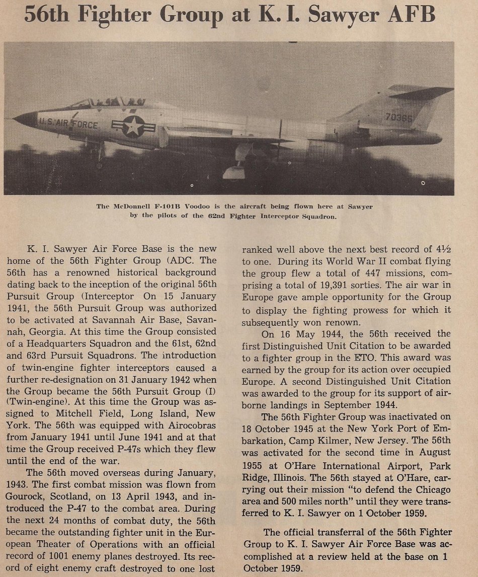
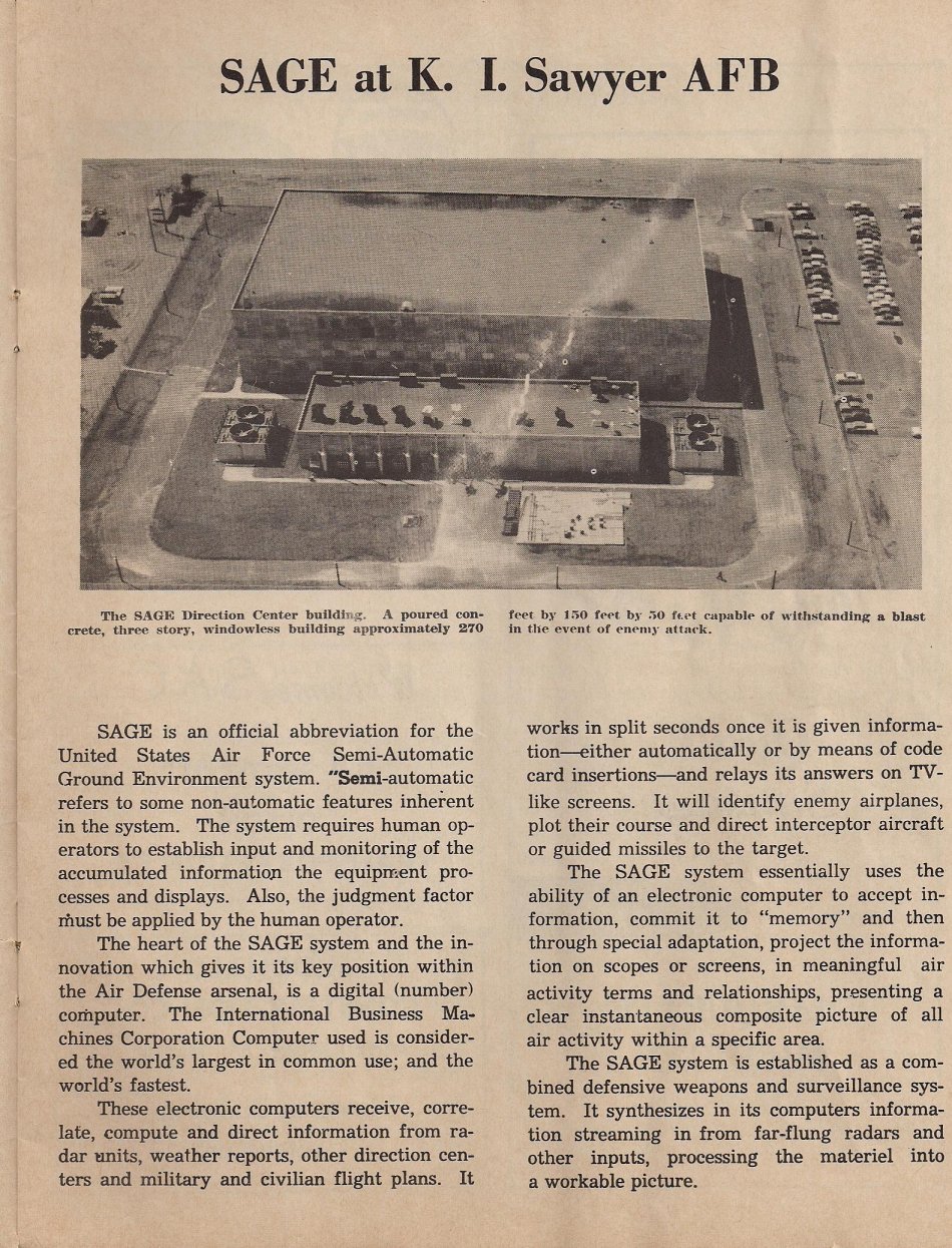
 |
 |
 |
 |
 |
|
|
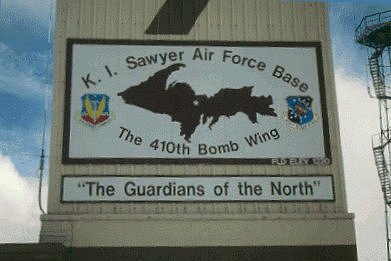
K. I. Sawyer Facts and Figures
Latitude: 46 degrees 21 minutes North
|  |

|
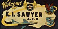
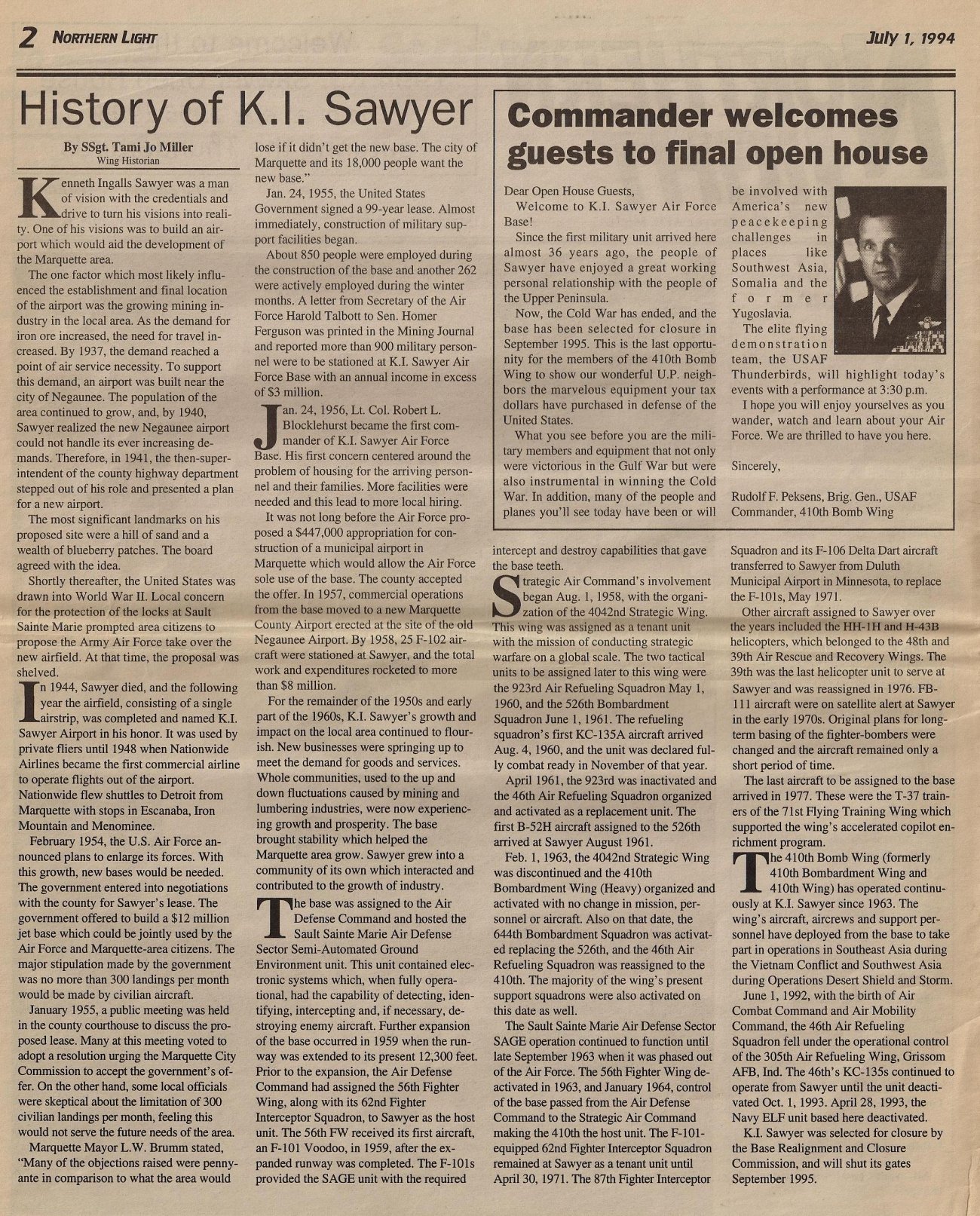
In 1954 the government entered into negotiations with Marquette County for Sawyer's lease. After several months of meetings and negotiations a 99 year lease
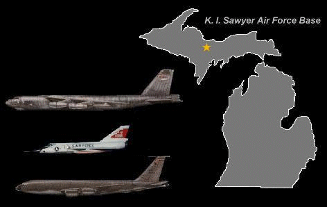
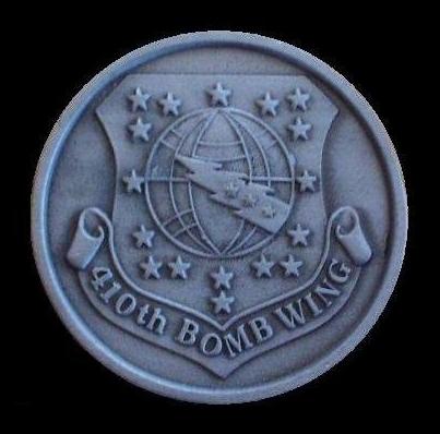
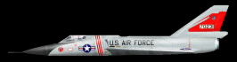
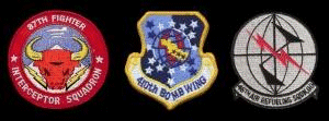
was signed on January 24, 1955. Construction started almost immediately. Approximately 850 people were employed during the construction and several local contractors were involved. Situated on over 5,200 acres of land in Michigan's Upper Peninsula, K.I. Sawyer Air Force Base was one of the newest major U.S. bases built by the Air Force. Utilizing the world-class air facilities located at Sawyer, aircraft operators have access to an all weather runway 12,300 feet long and 300 feet wide. Additionally, the region's wide open airspace offers ease of operations for an extremely safe and delay free air traffic setting. From a global perspective, great circle (polar) air routes available from K.I. Sawyer's unique location allowed shorter travel time to targets in the Soviet Union. On January 24, 1956 Lt./Colonel Robert L. Blocklehurst became the first commander of K. I. Sawyer AFB. The runway was completed in 1957 and in 1958 25 F-102 aircraft were sent TDY from Kinross AFB at Sault St. Marie to operateout of Sawyer for several months. This was due to the runways at Kincheloe being repaired and extended. The 62nd Fighter Interceptor Squadron from O'Hare airport Chicago was transferred to Sawyer and became an operational F-101B squadron in 1959 after the runways at Sawyer were extended to 12,300 feet. The Strategic Air Command became operational as a tenant unit with the assignment of a KC-135 Air Refueling Squadron and soon was replaced by the 46th Air Refueling Squadron. The first B-52H arrived at Sawyer in August 1961 along with the 410th Bomb Wing. The Sault St. Marie Air Defense Sector (SAGE) continued in operation until September 1963 and in January 1964 control of the base was passed from the Air Defense Command to the Strategic Air Command leaving the 410th Bomb Wing as the host unit to date. The 62nd Fighter Interceptor Squadron remained at K. I. Sawyer until it was deactivated in April 1971. In May 1971 the 87th Fighter Interceptor Squadron flying F-106A Delta Darts moved to K. I. Sawyer where it maintained readiness in all-weather intercept techniques, aerial refueling, and fighter versus fighter tactics. The 87th maintained four T-33 aircraft at K. I. Sawyer to provide target support for the squadron interceptors, simulating Soviet bomber tactics. In addition, they flew NORAD radar evaluation and logistic support sorties. The 87th was scheduled to convert to the F-15 Eagle in 1984. However, due to budget cuts the conversion was cancelled and the squadron again was scheduled for deactivation on October 1, 1985. In 1974 and 1975 FB-111 aircraft assigned to Pease AFB, New Hampshire were on satellite alert at Sawyer. The last aircraft assigned to Sawyer were six T-37B jet trainers of the 71st Flying Training Wing assigned to the ''Accelerated Copilot Enrichment Program'' in 1977 and are presently assigned to the ''Companion Trainer Program'' under the 410th Bomb Wing and the Air Combat Command. On June 1, 1995, an Inactivation Ceremony was held. By August of 1995 the Base Deactivation Ceremony took place. The last B-52H left K. I. Sawyer in November of 1994. The nineteen B-52H's from the 410th Bomb Wing were relocated to Barksdale Air Force Base and Minot Air Force Base and became part of the 2nd and 5th Bomb Wings. K. I. Sawyer closed on September 30, 1995. |
| Another brief history of K. I. Sawyer can be read by clicking here. |
| If you would like to read a more detailed history of K. I. Sawyer you can do so by clicking here. |
 |
 |
 |
 |
 |
 |
 |
 |
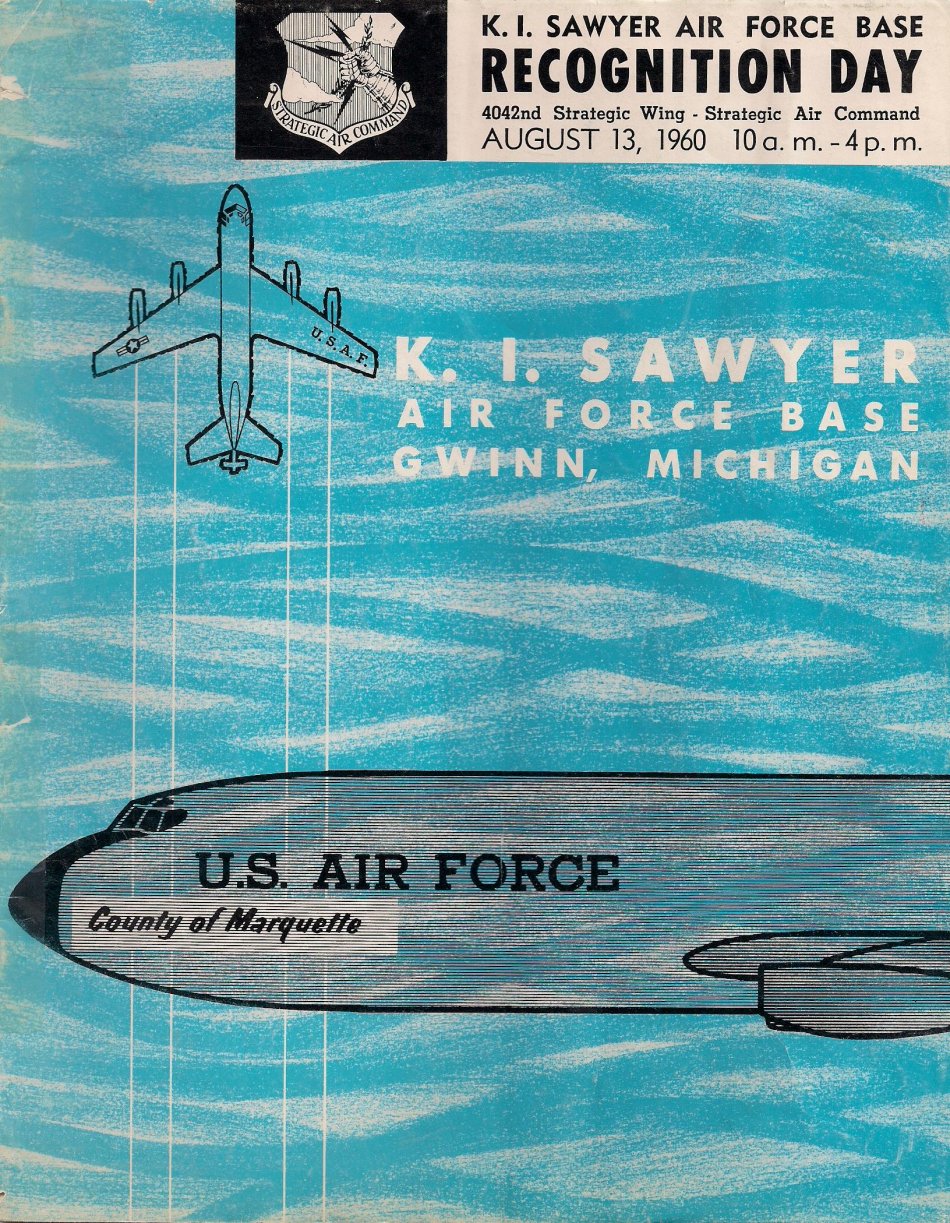
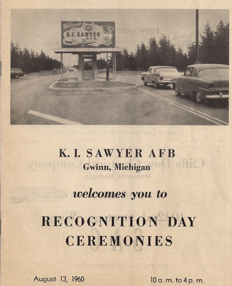
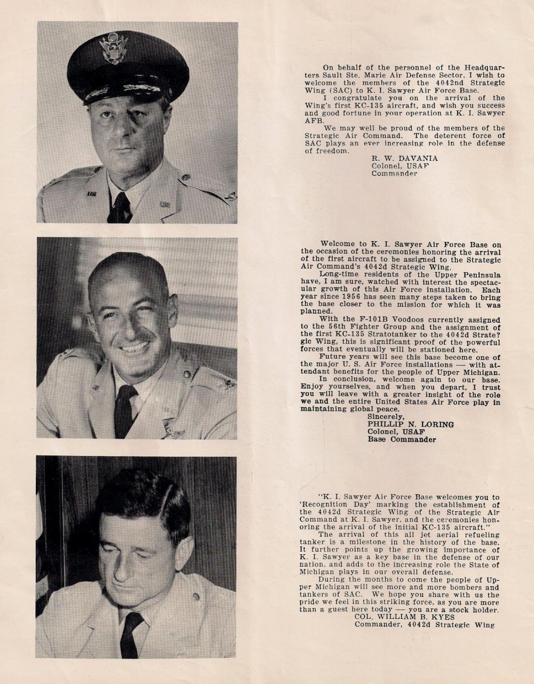
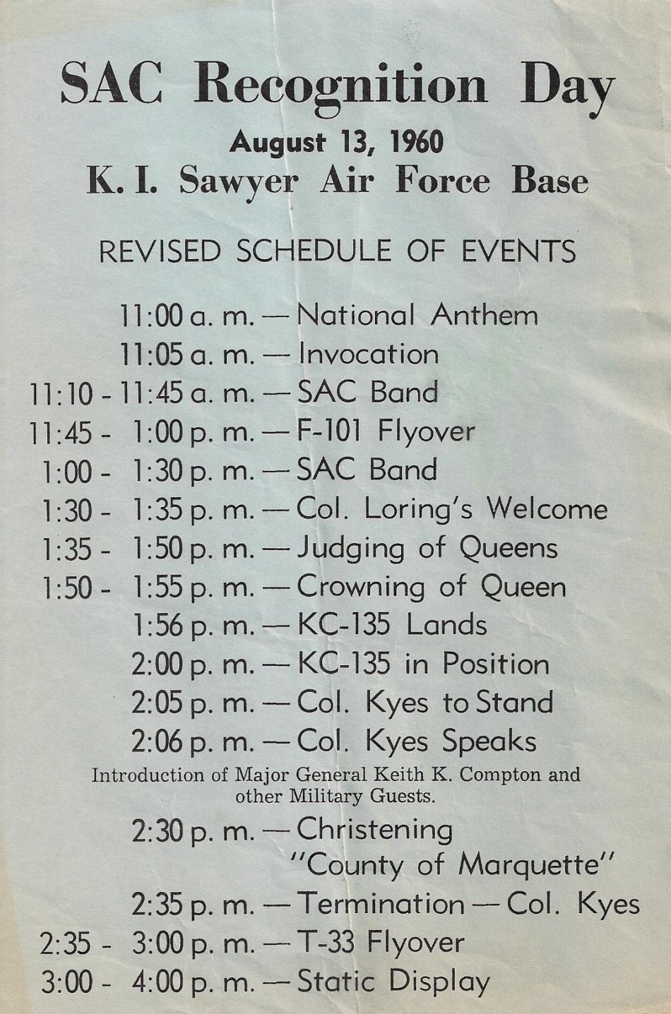
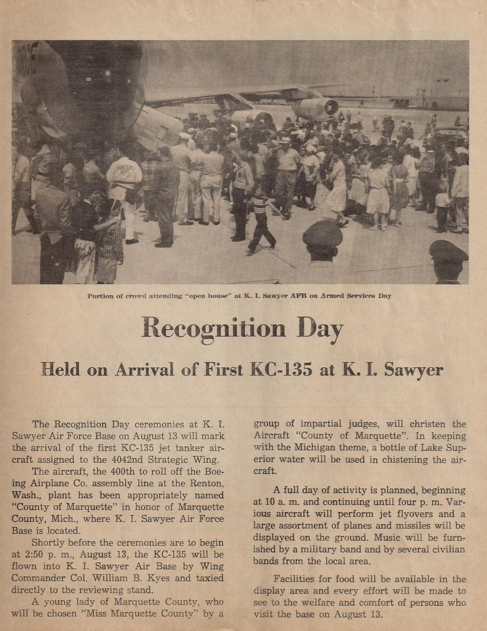
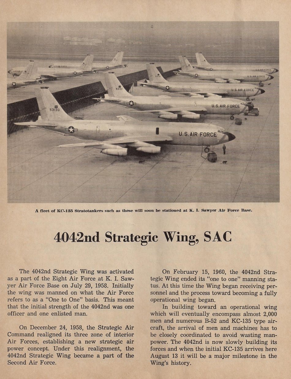
| The pages above are from an August 13, 1960 Recognition Day magazine published by K. I. Sawyer Air Force Base. They give a further history of the early years of the base. |
| On June 1, 1992 the Strategic Air Command merged with the Tactical Air Command to form the Air Combat Command. |
 |
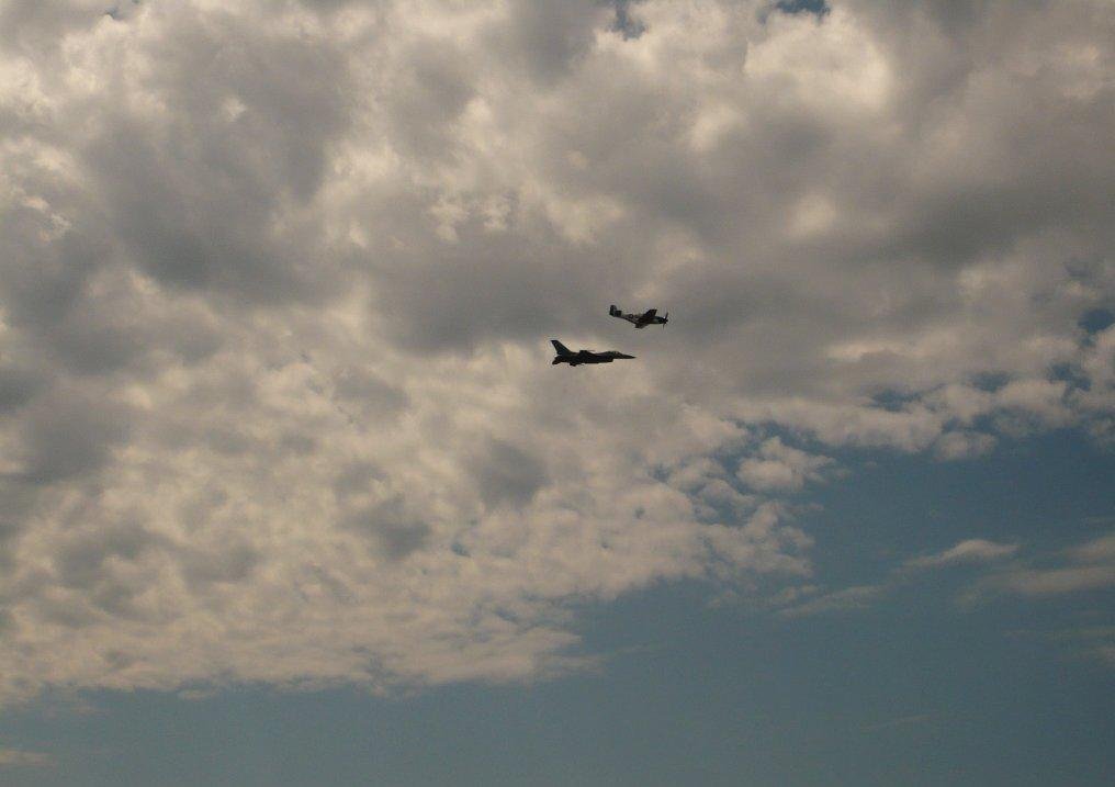 |
The USAF Heritage Flight, F-16 Fighting Falcon from the East Coast Demo Team and the P-51 Mustang ''Moonbeam McSwine''. Photo taken June 23, 2007 at the Sawyer Experience Air Show. The U.S. Air Force Heritage Flight (HF) program presents the evolution of USAF air power by flying today's state-of-the-art fighter aircraft in close formation with vintage fighter aircraft. An HF performance involves a current USAF fighter piloted by an Air Combat Command single-ship demonstration team pilot and flown with a historical warbird piloted by a trained and certified civilian HF pilot. The HF formations of modern fighters flying with World War II, Korean, and Vietnam era fighters such as the P-51 Mustang and F-86 Sabre, dramatically display our U.S. Air Force air power history and proudly support our Air Force's recruiting and retention efforts. In 2010, the Air Force Heritage Flight Foundation (AFHFF) was formed to keep this popular program flying. |
 |
 |
 |
 |
 |
 |
 |
 |
 |
 |
 |
 |
 |
 |
 |
 |
 |
 |
 |
|
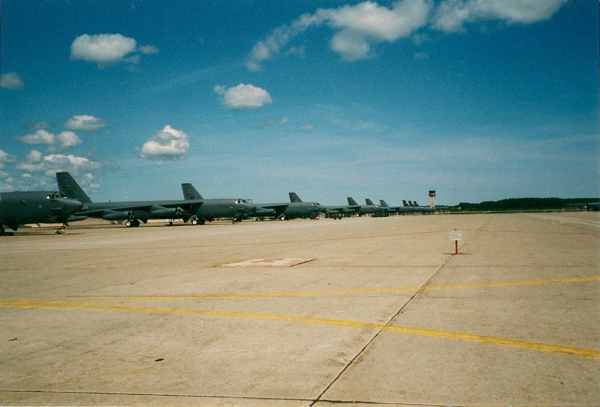
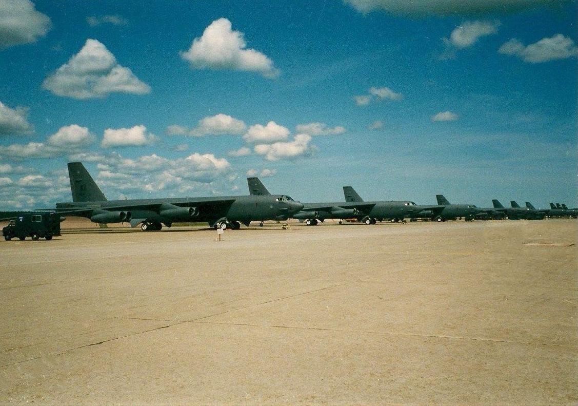
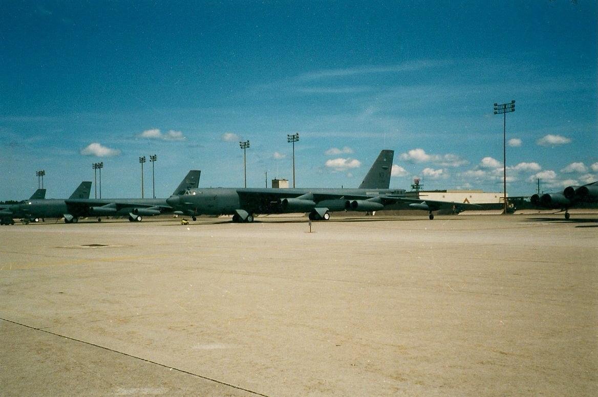
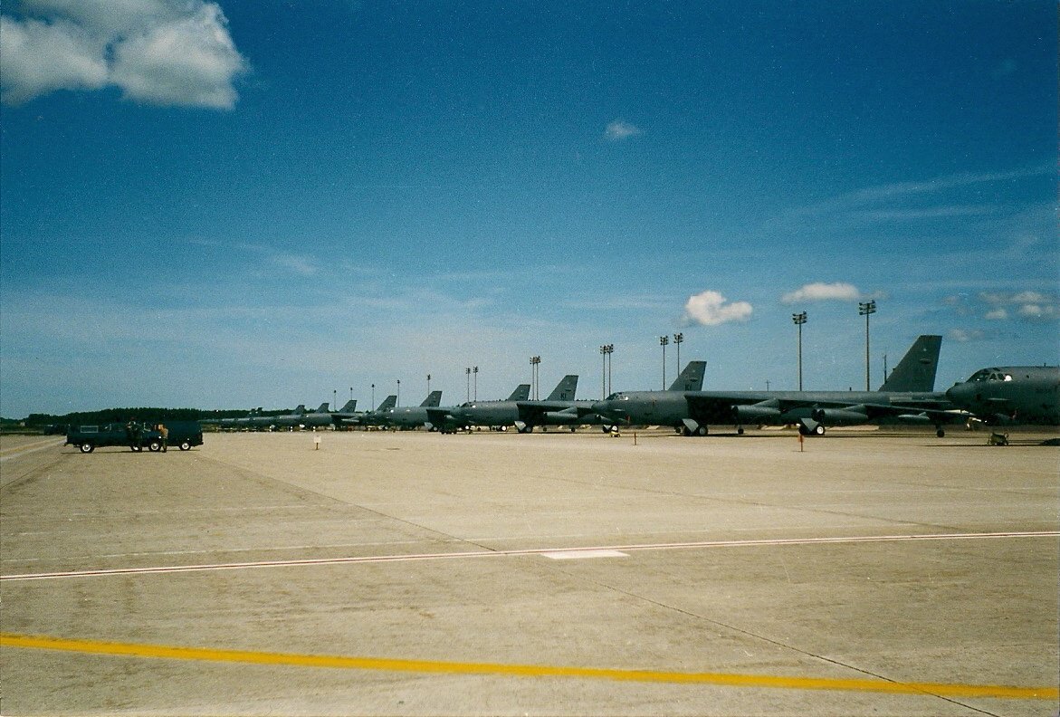
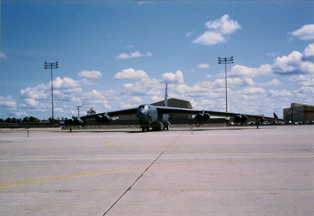
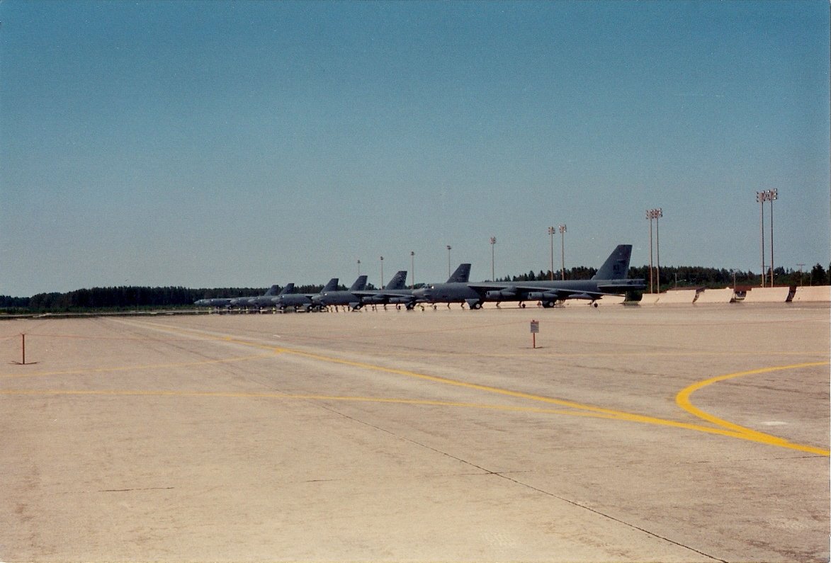
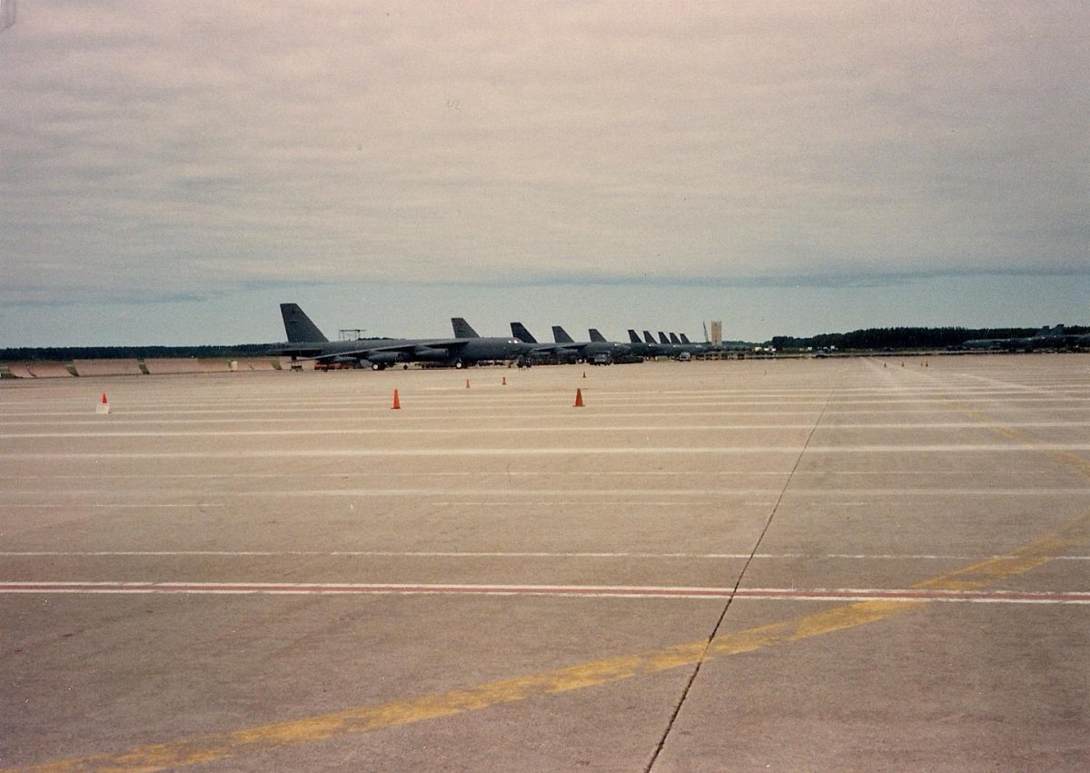
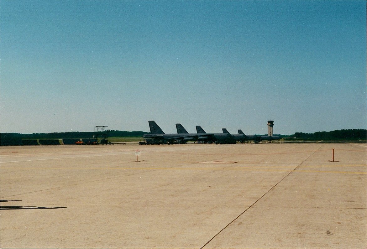
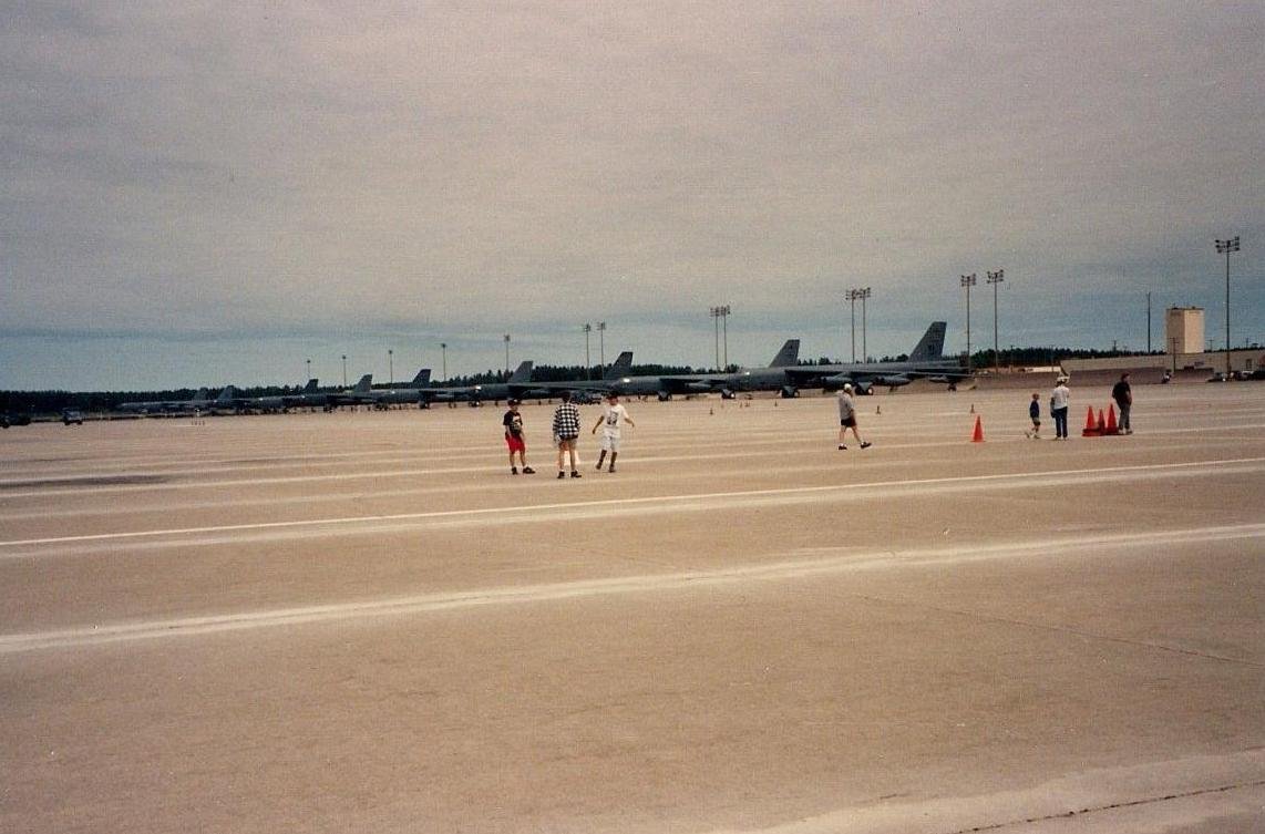
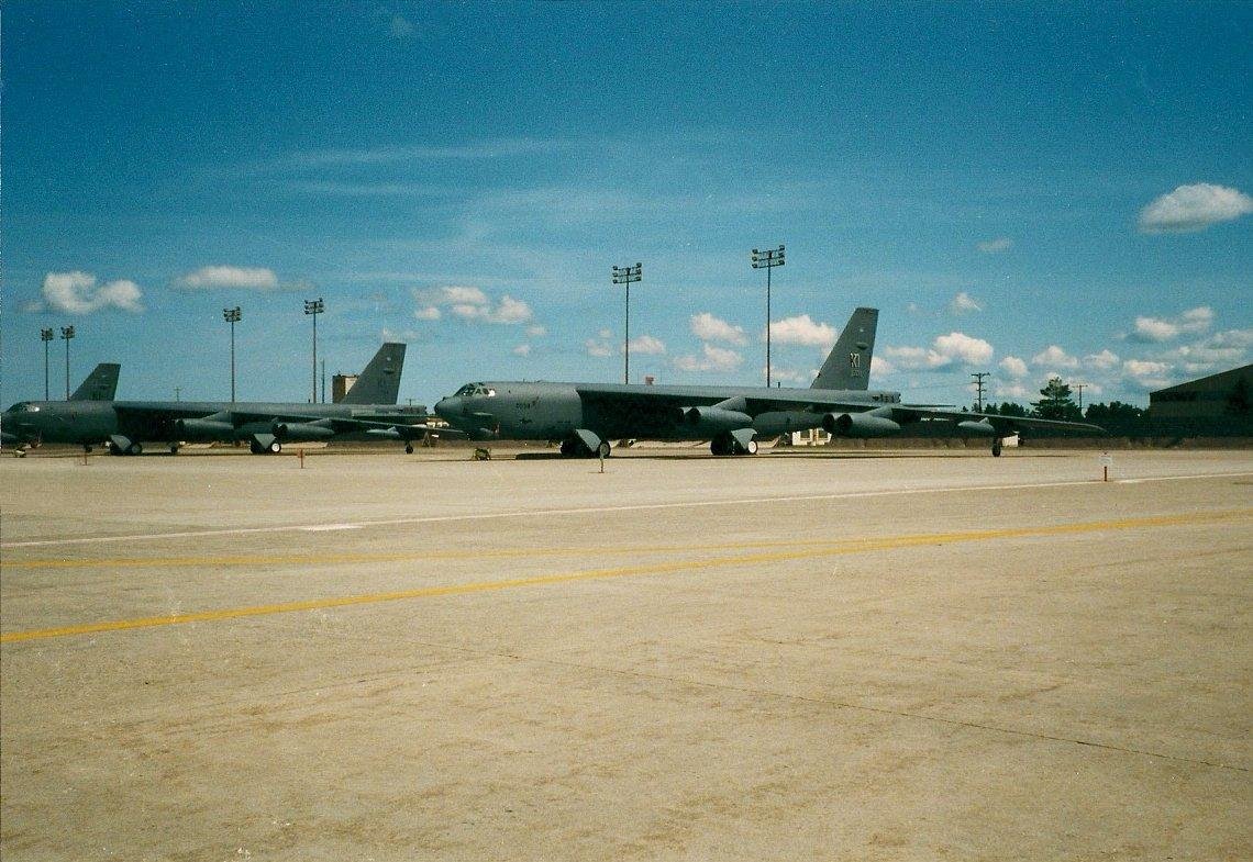
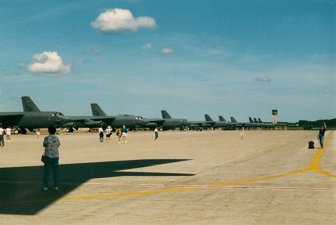
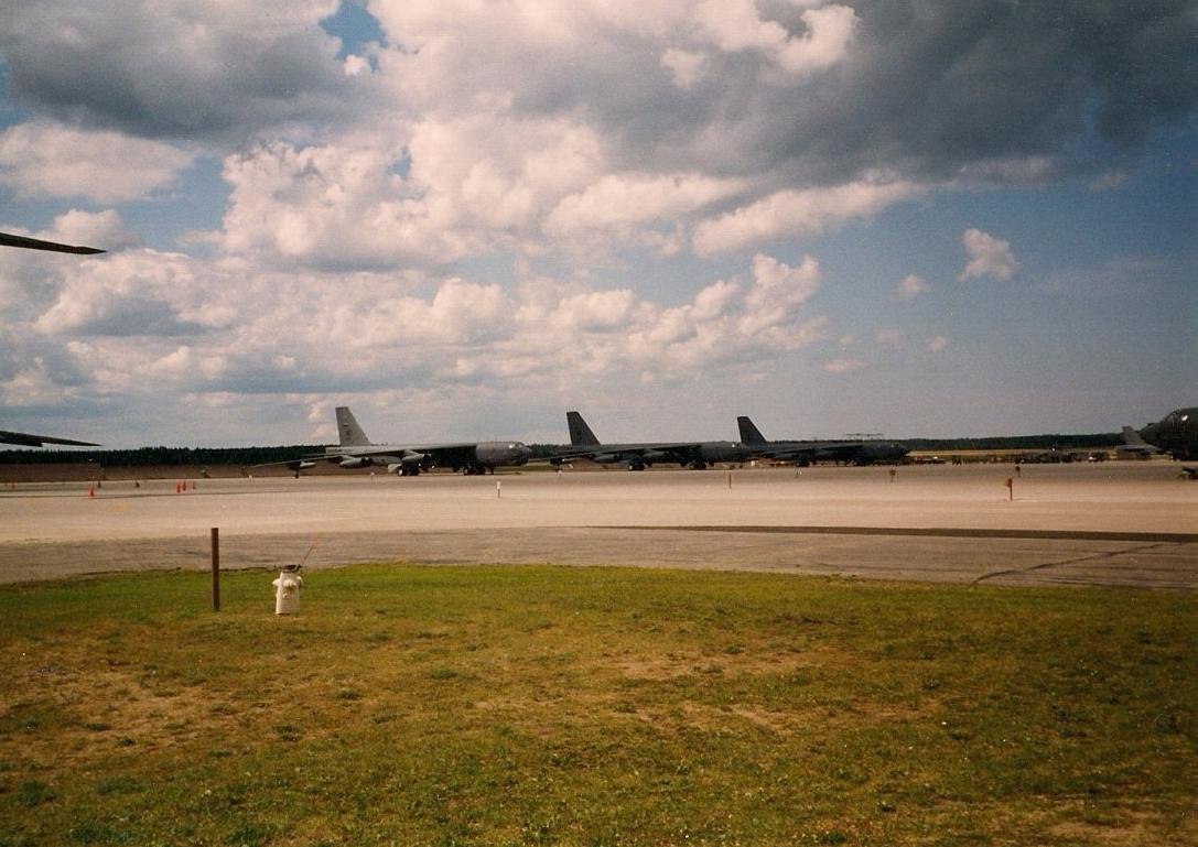
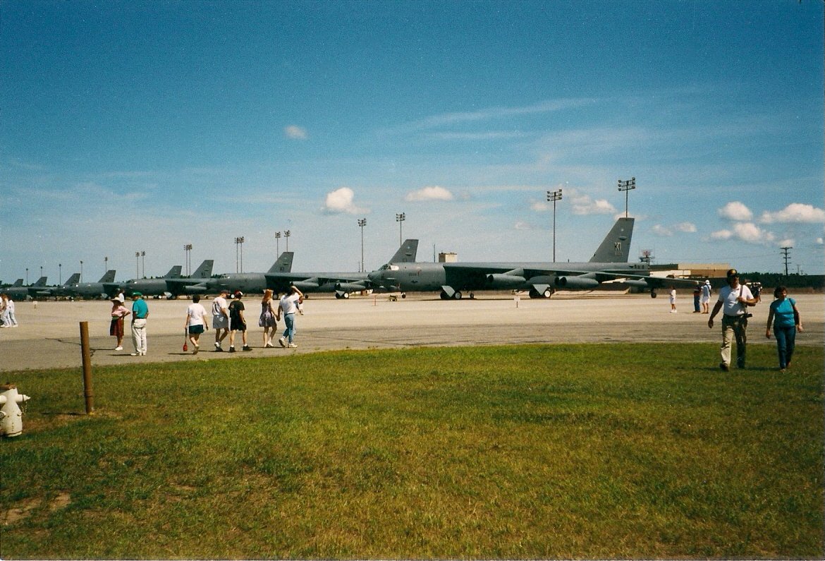
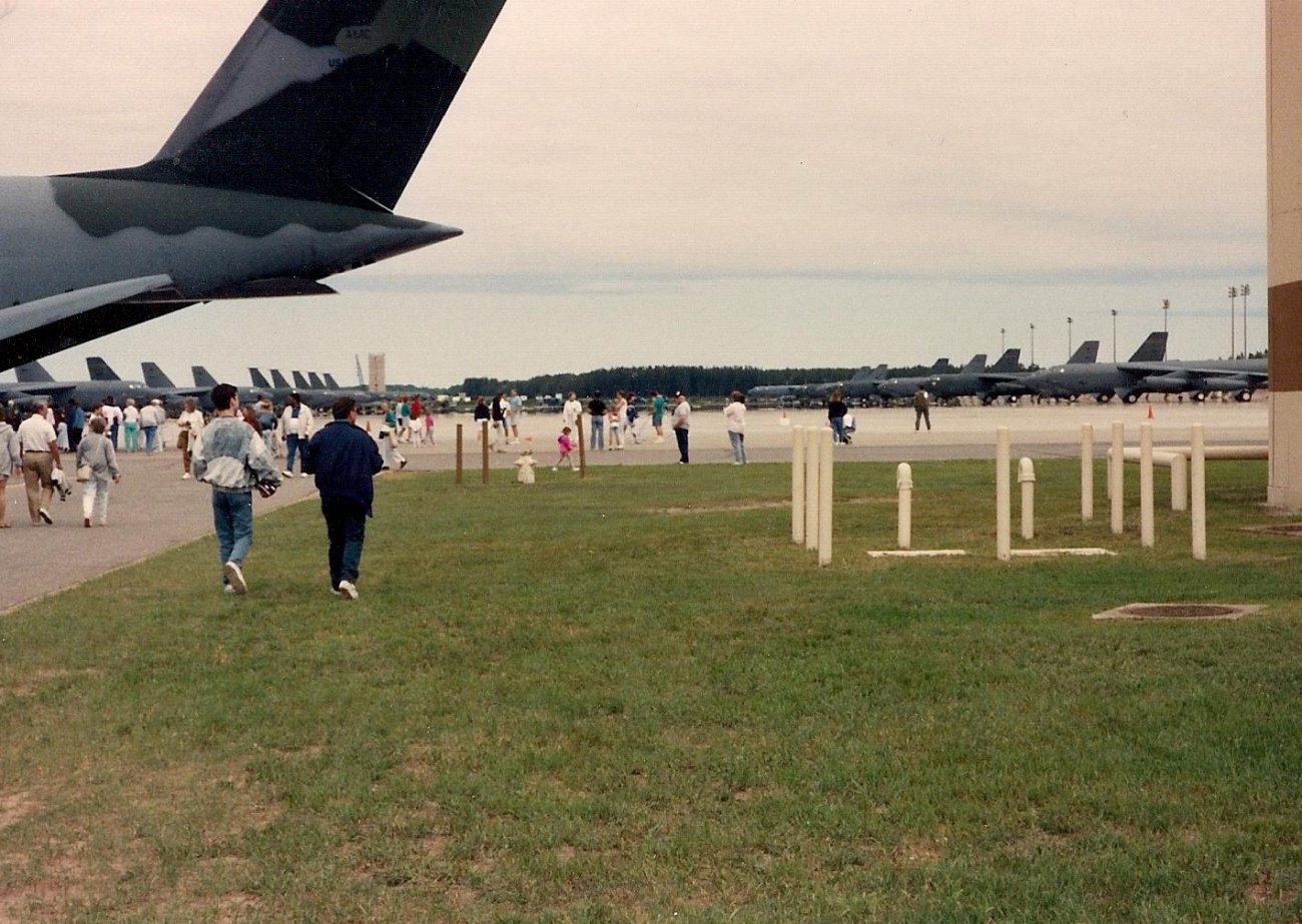
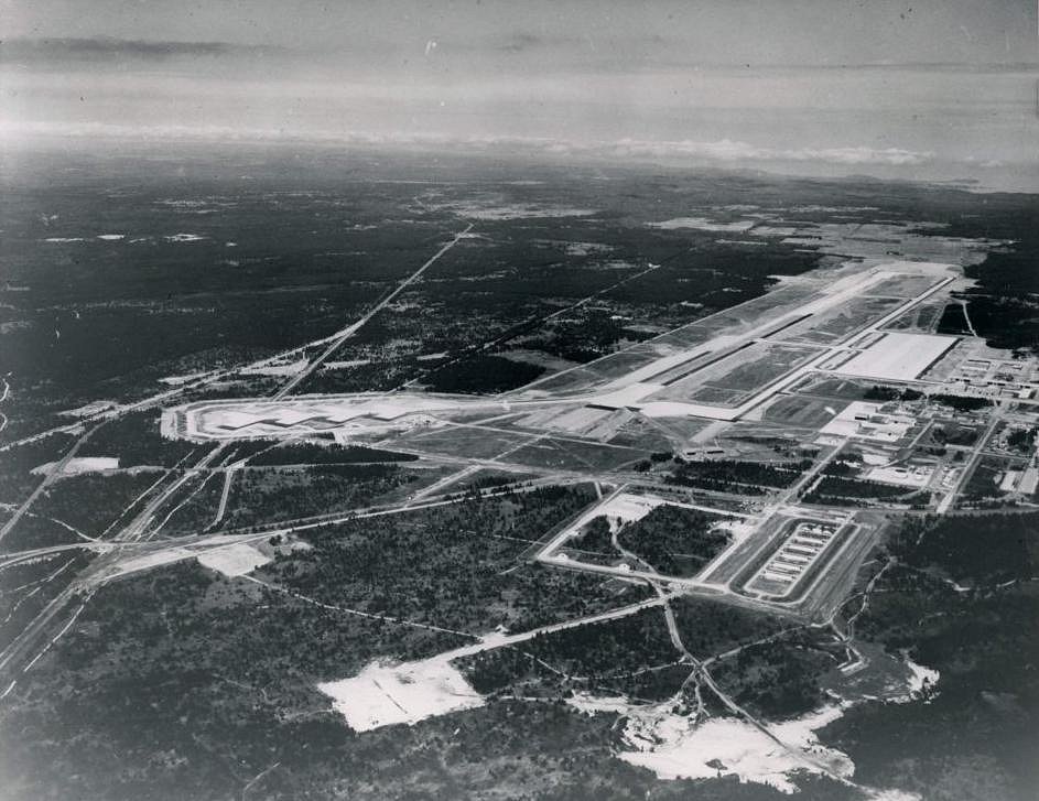
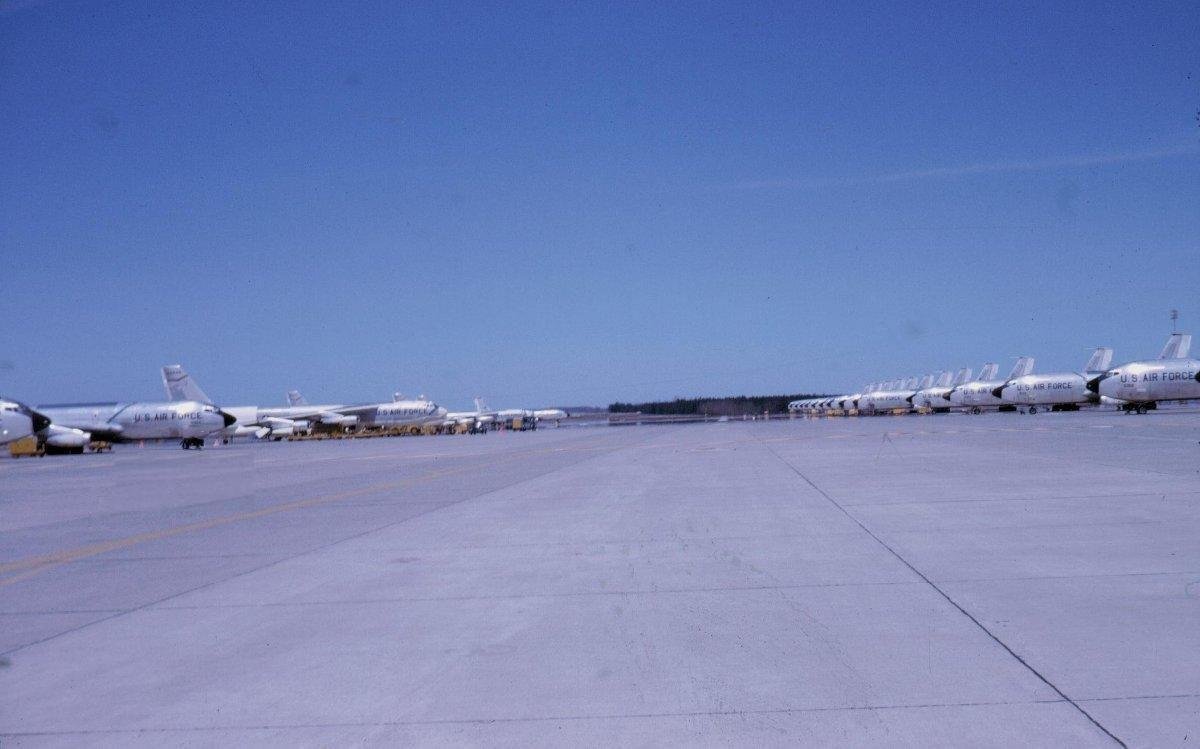
Gunship gray Boeing B-52H Stratofortresses from the 410th Bomb Wing and KC-135A Stratotankers from
the 46th Air Refueling Squadron line the large ramp area in these pictures from 1993 and 1994. The ramp covers four million square feet or one hundred acres.
The ramp consists of sixteen inch thick concrete. K. I. Sawyer was home to nineteen B-52H Stratofortesses. If you look closely at the bottom photo on the
extreme left you can see the completed new control tower. The control tower became operational shortly before the base closed in late 1995. Just below
the control tower you can see the dark tails of three KC-135A Stratotankers.
Ramp area picture orientation: south looking north. |
 |
|
|
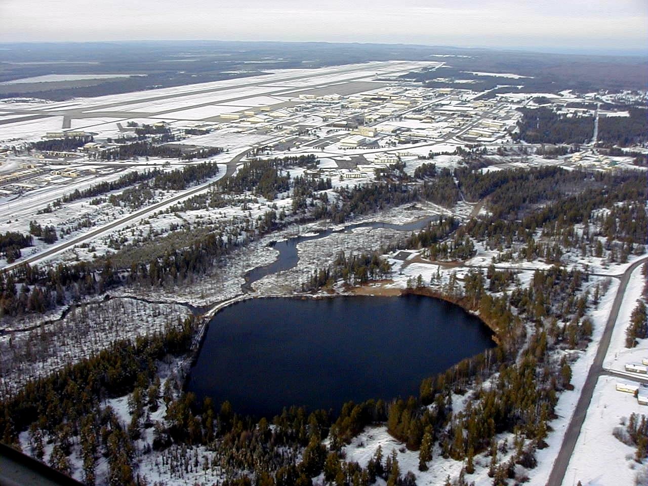 |
This picture of K. I. Sawyer was taken from the southeast section of the base. In the foreground is Little Trout Lake.
The road on the near left is Freedom Boulevard. Freedom Boulevard runs north where it intersects with
Avenue D and Avenue A, the south entrance to K. I. Sawyer. This picture was taken on November 16, 2000.
Picture orientation: south looking north. |
|
The picture to the right was taken from Freedom Boulevard at the intersection with Scorpion. The large lumber yard on the near
left is owned by Louisiana Pacific. This area was once used as the base weapons storage area. This picture was taken November 16, 2000.
Picture orientation: south looking north. | 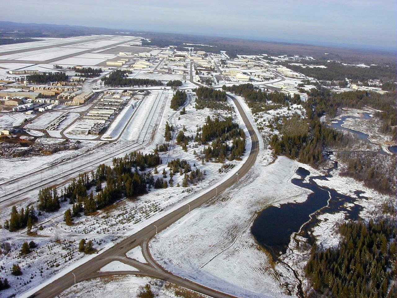 |
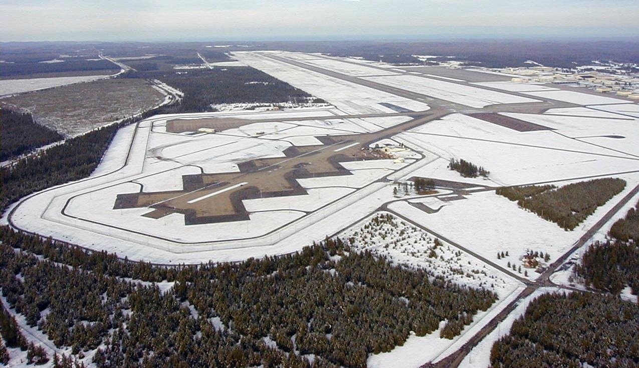 |
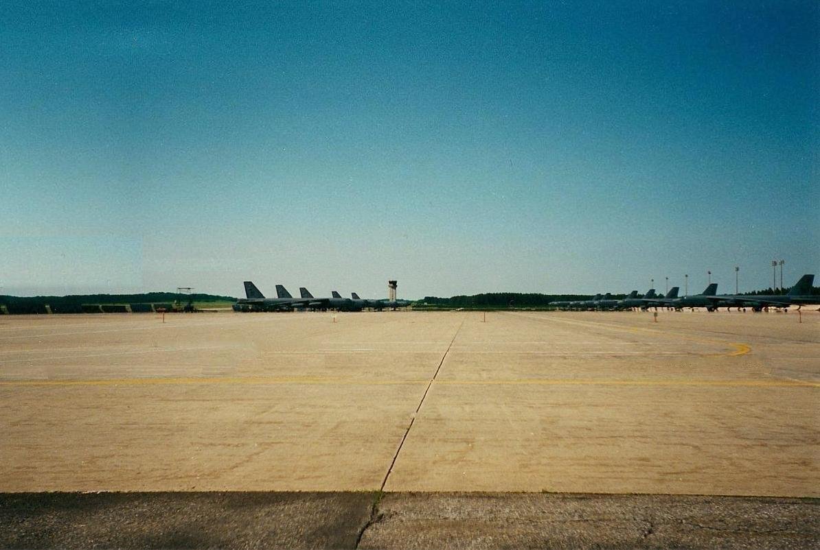
A view of K. I. Sawyer taken from the alert facility located on the southwest section of the base. The alert facility is where B-52H Stratofortresses
and KC-135A Stratotankers were stationed while on alert status. Up to nine B-52H's were parked on what was called '' The Christmas Tree ''.
KC-135A's on alert were parked on the square ramp to the north. The facility where air crews were stationed while on alert can be seen on the right
side of the alert apron. The alert apron connects with the 12,300 foot long main runway 01-19. The large ramp area can be seen in the far northeast
section of the base. This picture is from November 16, 2000.
Picture orientation: south looking north. |
 |
 |
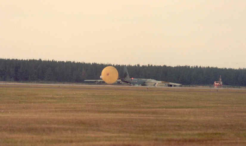
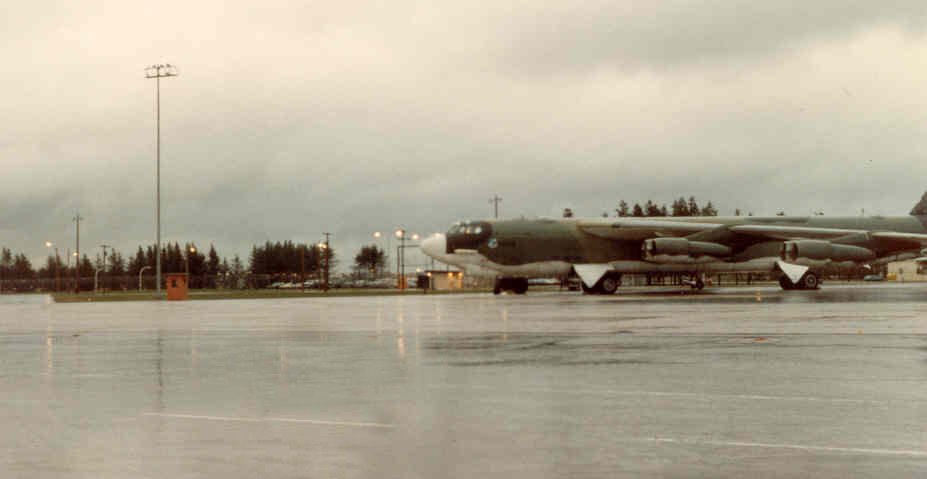
Far left: A B52H from the 410th Bomb Wing shortly after landing with chute deployed. This photo was taken between 1980 and 1982.
Near left: A winter photo of B52H Stratofortresses from the 410th parked on the large ramp area on the northeast section of Sawyer.
This photo was taken between 1980 and 1982.
|
|
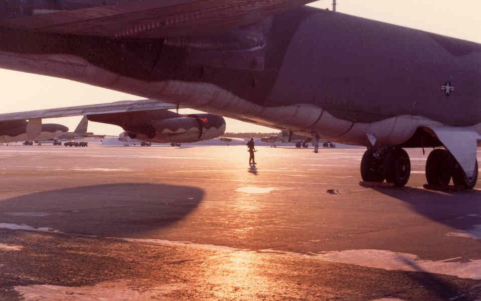
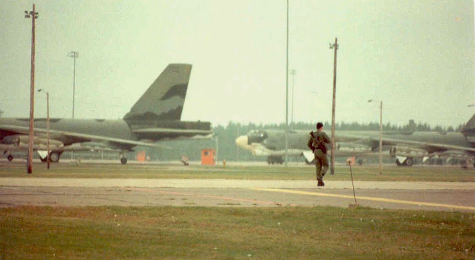
To the right are photos of B-52H Stratofortresses from the 410th parked on the alert facility. These photos were taken between 1980 and 1982.
(Photos courtesy Jamie Smith 410th Security Police)
|  |
 |
 |
 |
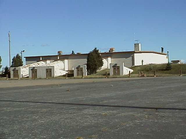 |
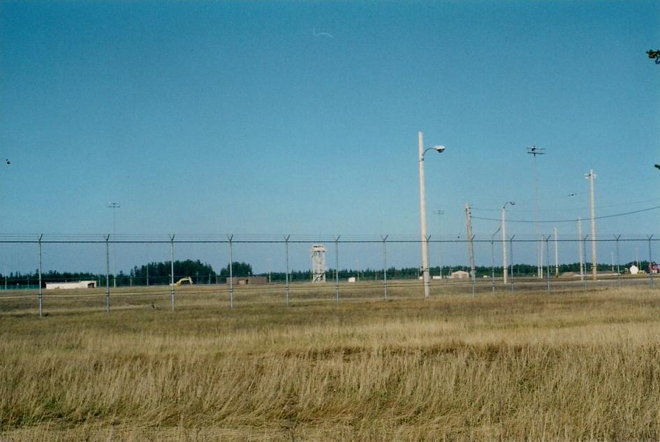
Far left and center: A view of the alert facility, building number 104, located on the southwest corner of K. I. Sawyer.
This picture was taken from the old entrance road to Sawyer. Note the guard tower in the center of the picture on the far left.
Picture orientation: south looking north.
Near left: A closer view of the alert faclity taken from the alert apron. Five tunnels from the facility can be
seen in this picture leading to the alert apron. The majority of this facility is located underground.
|
|
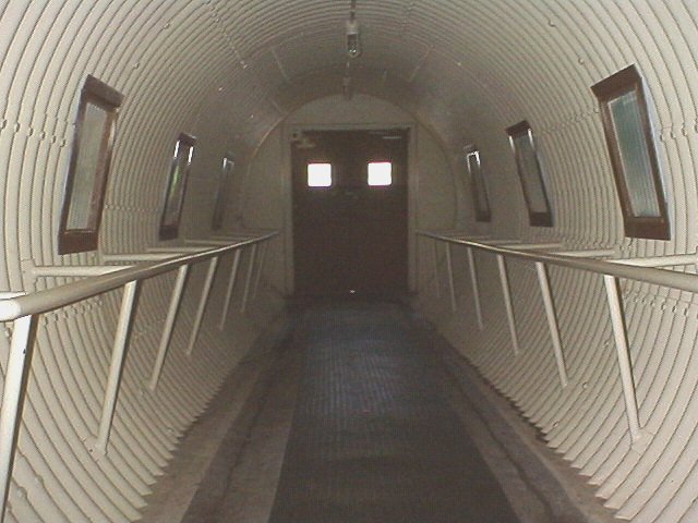
Near right: The north tunnel in the alert facility leading to the alert apron.
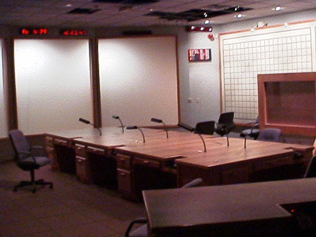
Center: A view of one of the other tunnels in the alert facility leading to the alert apron. Far right: The Command Center of the SAGE facility, building number 708, located on the northeast section of K. I. Sawyer on Avenue D. | 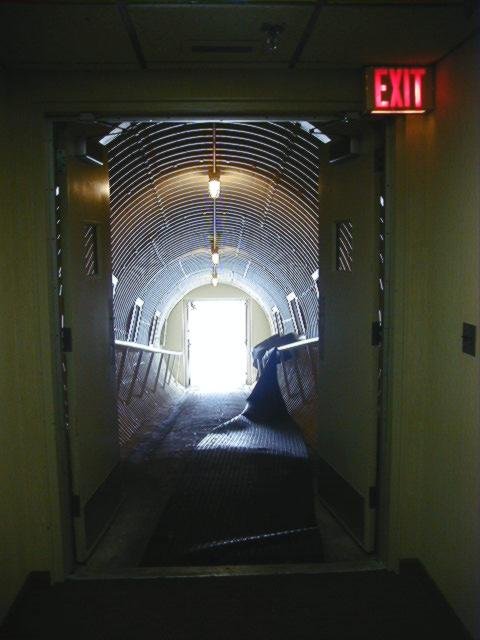 |
 |
 |
 |
|
|
|
 |
 |
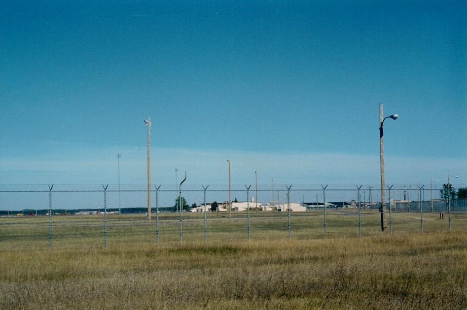
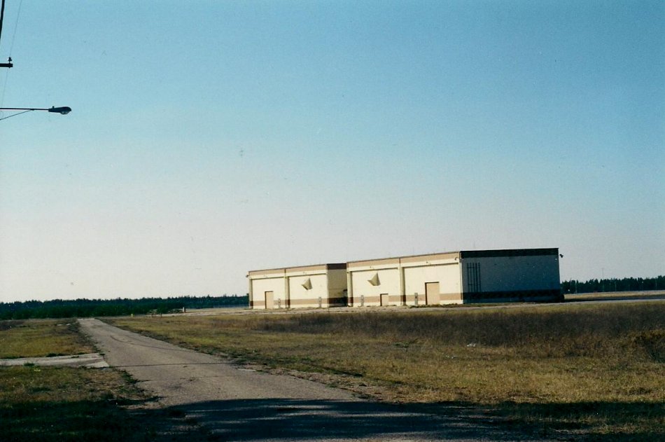
Far left: A view of the rear of the F-106 alert hangers. This facility was used by the 87th Fighter
Interceptor Squadron. Four F-106A Delta Darts were stationed here on what was called ''hot alert''. This
facility is located on the southeast section of the base. This picture was taken from Avenue H.
Near left: Another view of the fighter alert hangers. This picture was taken from the old entrance road to K. I. Sawyer. Sometime
in the 1980's a new road was built farther south and away from the alert areas and the old entrance was closed. The new road is called Freedom Boulevard.
|
|
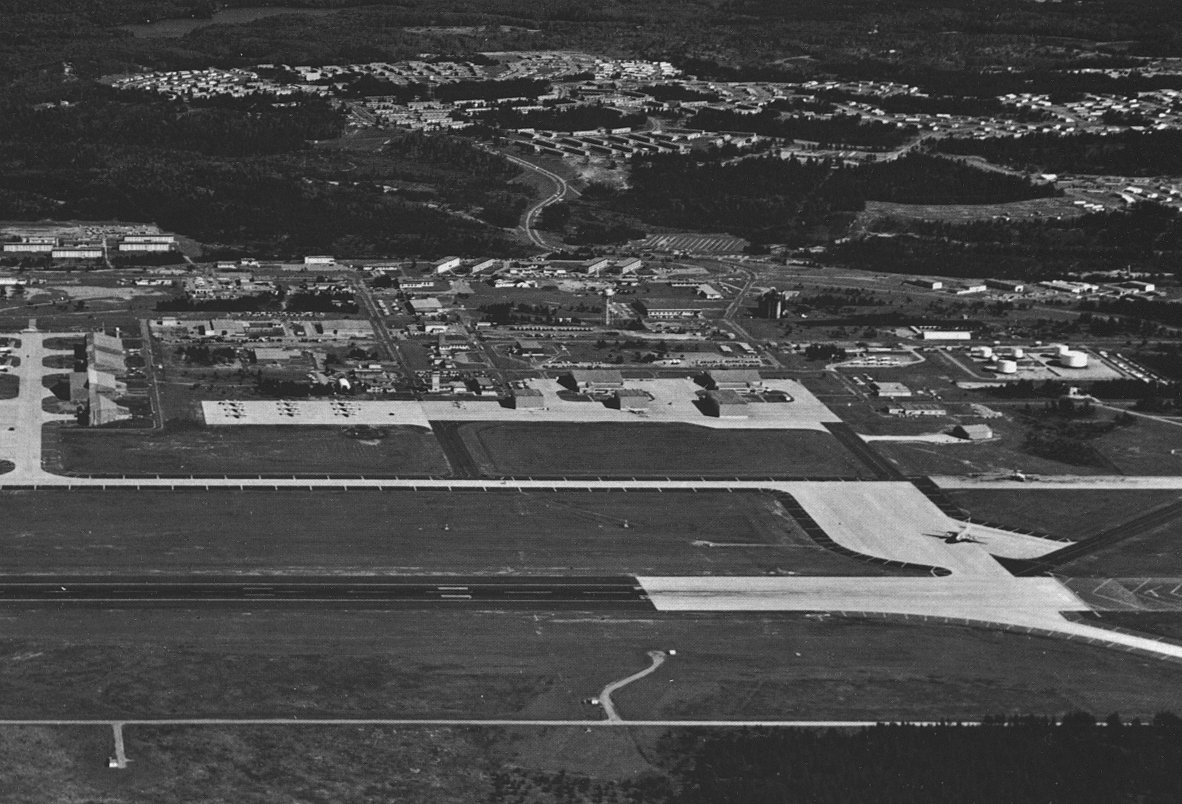
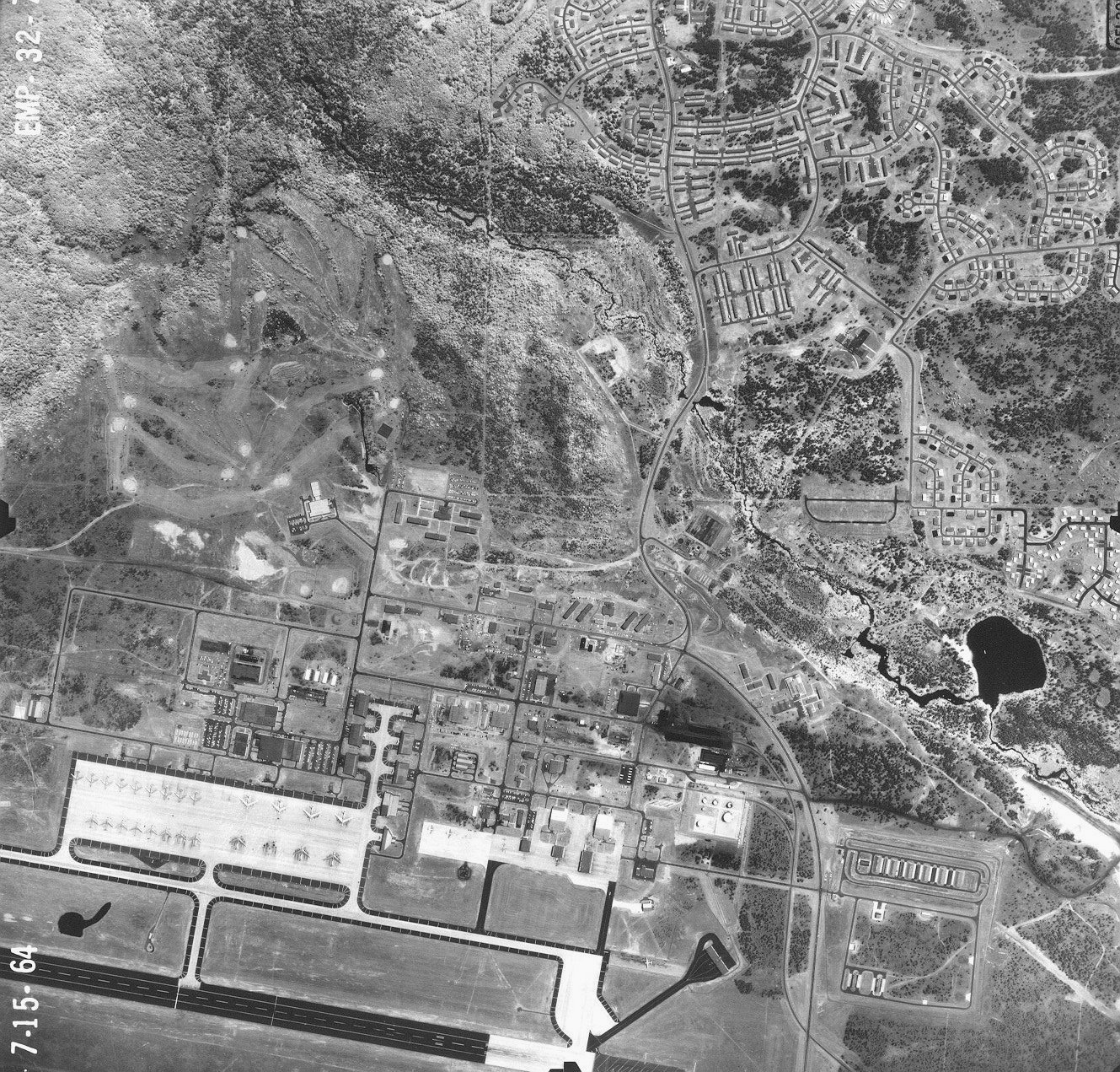
Near right: A view of K. I. Sawyer taken in 1959 looking to the north.
Center: An aerial view of K. I. Sawyer looking to the east. This photo is from the 1960's. Far right: An aerial view of K. I. Sawyer as it appeared in 1964. (Photo courtesy Joe Sullivan) |
 |
 |
 |
 |
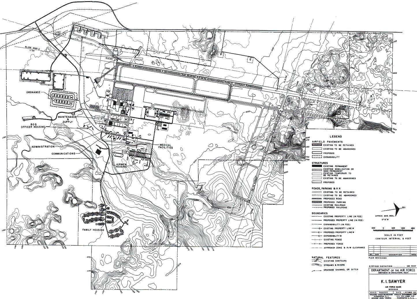 |
Far left: A great picture of the ramp area taken in July of 1963.
Picture orientation: south looking north. Near left: A topigraphical map of K. I. Sawyer from October 1957. Sawyer started out in the 1950's as a fighter base under the control of the Air Defense Command. The 410th Bombardment Wing did not move into Sawyer until February 1, 1963. The Strategic Air Command did not move in until January 1964. |
 |
 |
 |
| Sign My Guestbook | Click on The Main Gate for the next page |
| You are visitor number | since November 18, 2006 |